


Description
- High-resolution digital images printed with archival inks on German etching paper.
- 14″ x 16″ – unframed prints
Details
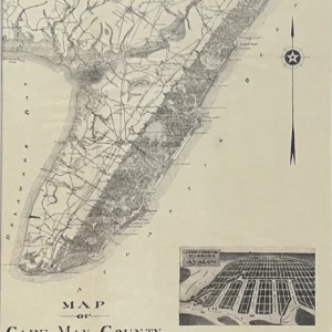
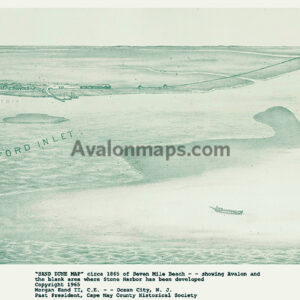
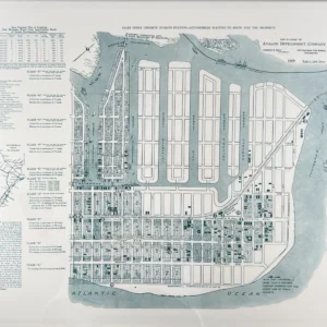
- Sea Island or Seven Mile Beach (Avalon, Stone Harbor), Ludlam’s Beach (Sea Isle City), Peck’s Beach (Ocean City), as well as Cape May and Cape May Point
- Hereford Inlet, Townsend’s Inlet, Corson’s Inlet, the former Turtle Cut Inlet, Cold Spring Inlet and the Cape May Lighthouse
- Ludlam’s Bay, Leaming Sound, Nummy Island and Grassy Sound
- Rio Grande, Cape May Court House and Seaville, Cape May Railroad, creeks, and early roads
Shipping Information
Orders are typically shipped within 10 days from receipt of payment. Some orders may require longer lead time based on the size of the map.
Framing Options Available
If you would like to have your map professionally framed, we have someone in-house who can provide this service. Please contact Dave Mackey directly at davidmackey1@comcast.net.
There are no reviews yet.